Clickhere for a larger viersion of this map.
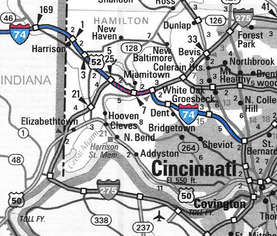
Construction of I-74 began in 1958 in Indiana and wascompleted with its terminal connection to I-75 in Cincinnati in 1974. It branches from I-75 four miles north of downtown and cuts diagonally (pictured above) acrossthe Mill Creek Valley before following the creek's west fork through Mt.Airy Forest. After a steady climb to the North Bend Rd. interchange,the expressway descends into the Great Miami River watershed and interchangeswith I-275. I-74 is multiplexed with I-275 for about two miles before branching westfrom the loop expressway toward Indianapolis. I-74 terminates approximately350 miles west, at an interchange with I-80 in Bittendorf, Iowa.
Clickhere for a larger viersion of this map.
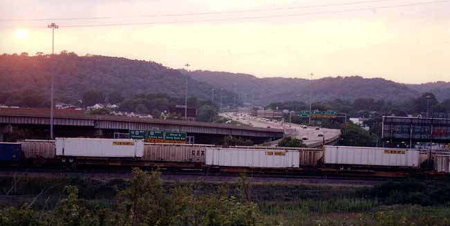
I-74 through Cincinnati does not involve any tunnels or majorbridges and the style of construction is similar to most of I-71 and I-275. But it is notable for traveling through varied environments in an unusuallyshort distance, from the old densely built Mill Creek Valley to the woodedhills of Mt. Airy Forest in just a minute or two of driving time. And withonly trace glimpses of suburban development visibile from its path, I-74offers the most pleasant expressway approach to Cincinnati. No doubtthe unknowing highway traveler is given a much different impressionof Cincinnati from the wooded hills of I-74 than from any other approach.
1. I-74/75Interchange
2. Northside/ Colerain Expressway Interchange
3. Mt.Airy Forest
4. I-275Interchanges / Points West
5. I-74Extentsion?